Have you ever wondered why the Alaska / Canadian British Columbia border looks so very odd, what with a slim panhandle running one third of the way down the BC coast? Alaska was once owned by Russia. Their right was based on the establishment of fur trading locations at places such as Wrangell and Petersburg. and was confirmed in a treaty between Russia and the UK in 1825.
When the US purchased Alaska in 1867 they took over what Russian maps showed to be Alaska. However the Russian maps showed more land belonging to them than stipulated in the treaty of 1825, which was the last document to have set the boundary.
In 1872 British Columbia petitioned for an official survey of the boundary. The U.S. repeatedly dismissed the request, deeming it too expensive.
In 1898 a joint high commission met to discuss the Alaska Boundary Dispute at which time both sides agreed to a compromise. Unfortunately news of the compromise got out, and the western states vehemently protested, forcing the U.S. to meekly drop the compromise.
Later that same year Britain and the U.S. met to decide on a tribunal to settle the Alaska Boundary Dispute. They could not find a compromise and discussions were halted.
When Teddy Roosevelt won the presidency, he applied his motto, “speak softly and carry a big stick,” towards solving the dispute. Americans began a series of harassment measures against Canada. Canadian miners in Alaska were denied certain legal rights, because of a loophole in the Alaskan Homestead act of 1899. The U.S. also erected settlements along the Southern Panhandle border. The final harassment was policy unofficially adopted by U.S. shipping companies, which slowed Canadian shipments and sped up U.S. shipments.
Finally in 1903 the Hay/Herbert Treaty called for a six member tribunal, made up of three Americans, two Canadians and one British member, to make a decision.
In January of 1903, the U.S. and Britain agreed on a format to address the boundary dispute arbitration. Each side was to appoint three impartial judges of repute. Legal teams would present their cases and the tribunal would then render a decision.
Theodore Roosevelt made his three impartial selections. He appointed Elihu Root, Secretary of War; Henry Cabot Lodge, Senator from Mass, and George Turner Ex-Senator from Washington. Using his Big Stick policy, Roosevelt sent word that if the panel didn’t find correctly he would send marines in to secure U.S. rights.
So much for impartiality!
On the other side Britain appointed Baron Alverstone, the Lord Chief Justice of England; Sir Louis A Jette, Lieutenant Governor of the Province of Quebec; and Allen B. Aylesworth, K.C., From Toronto. Canada was confident they would receive British support due to the help they gave the British in the Boer War.
The reality of the situation was that Britain was more concerned about their relations with the U.S. than with Canada. British needed U.S. Steel and sympathies for an arms race with Germany. Canada was a British Dominion. Thus its interests were relegated to bargaining chips. The other reality was that the Canadian Legal team had a weak case.
After three weeks of discussion and pouring over every document that was relevant to the dispute, The tribunal… surprise, surprise… voted in favor of the U.S. The Alaskan Boundary was established on paper, and various expeditions were ordered to properly survey the area. The Alaskan Boundary Dispute then faded from American recollection.
This is not true for the Canadian Collective memory. The deciding vote came from Baron Alverstone, the British member of the tribunal. Canada thought the British would protect their interests, and consequently view the dispute as a betrayal.
The Canadian Government reacted by changing its policy in the North. They had been told that they could not keep the Alaska Panhandle because they did not assert Canadian sovereignty there, so they changed this by sending Northwest Mounted Police to areas in the far North that were in danger of a similar dispute, such as Hershal Island in the northern Yukon Territory.
(This fact goes along ways to justify exerting our sovereignty over the northern ocean!)
Soon after the Alaska Boundary Dispute the Canadian Government raised the duties to bring goods across the border. This hurt the economy of Skagway, the primary border town in the Yukon region. Also, after gold was discovered in Atlin, B.C., the government restricted the ownership of claims to those holding Canadian citizenship. Both policies- the expensive duties and ownership rights- were directed at Americans, apparently in revenge.
The Yukon initially reacted negatively to the Council’s decision, but positive results have come from it with increased American investments in the Yukon and a strong Canadian Presence with the Northwest Mounted Police.
Since the final decision was made on October 20th, 1903 the outcome of the Alaskan Boundary Tribunal has never been seriously challenged by the US and Canada.
Special Note:
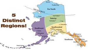
A recent note from a reader pointed out a problem with this article. It may sound to some that the Alaska Boundary Dispute was over the actual Alaska handle. We did not mean to leave that impression. The dispute was rather over the location of the border down the handle. As you can see in the image to the left (sorry about the quality), the red line indicates the Canadian declaration of the line. The blue is the American case. The yellow line indicates where the border finally ended up.
It is interesting to note than neither the American nor Canadian claim went as far south as the yellow line. I wonder how that happened?